

Lidar 3D Mapping
LiDAR (Light Detection and Ranging) 3D mapping is a remote sensing technology that uses laser light to measure distances and generate precise, high-resolution three-dimensional representations of environments.
Lidar 3D Mapping
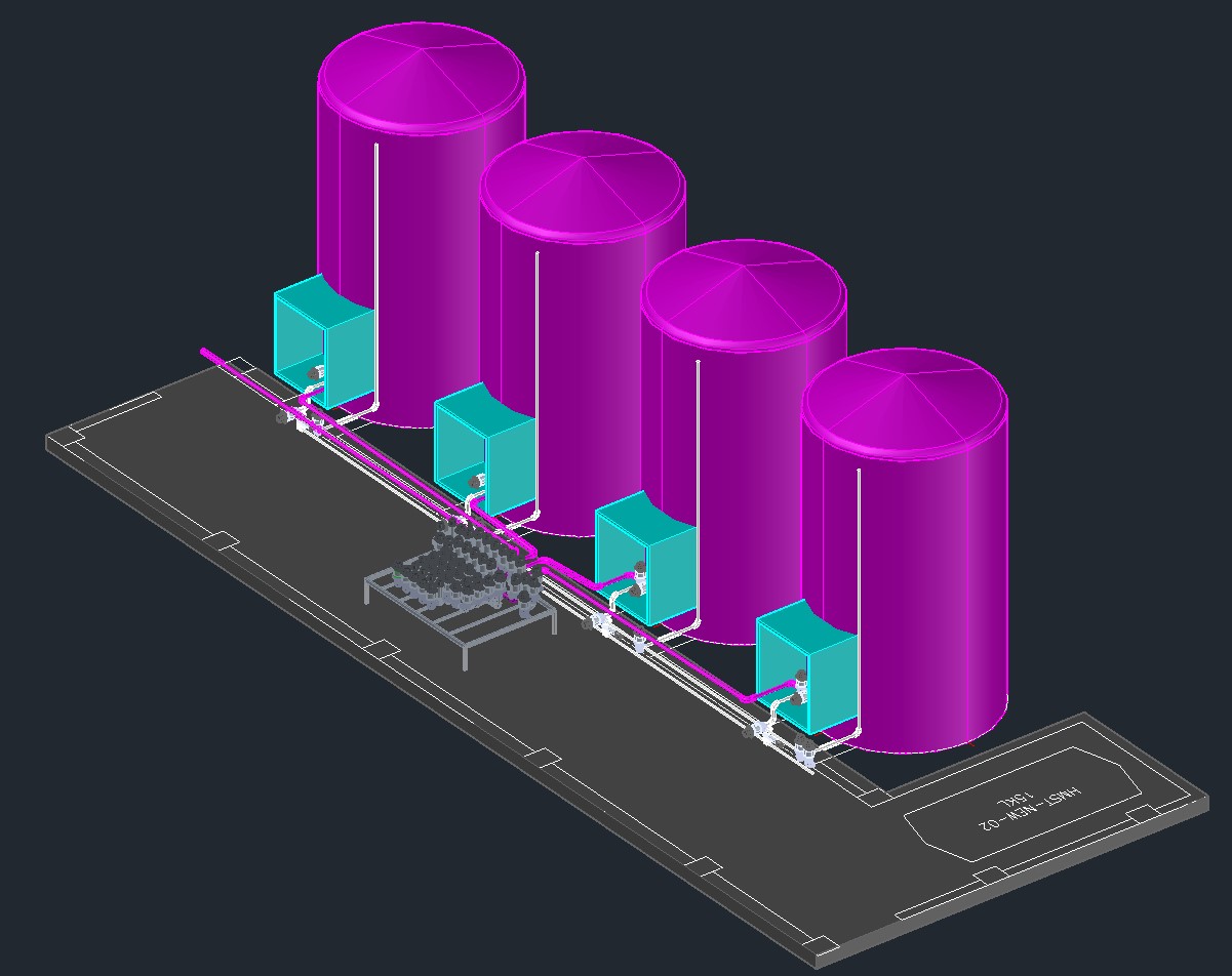
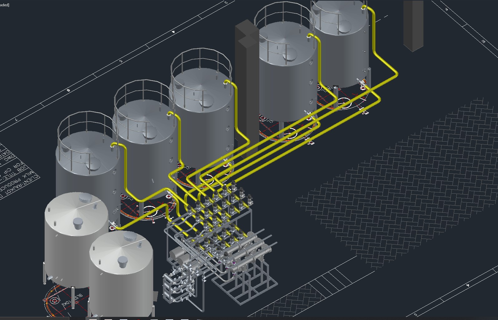
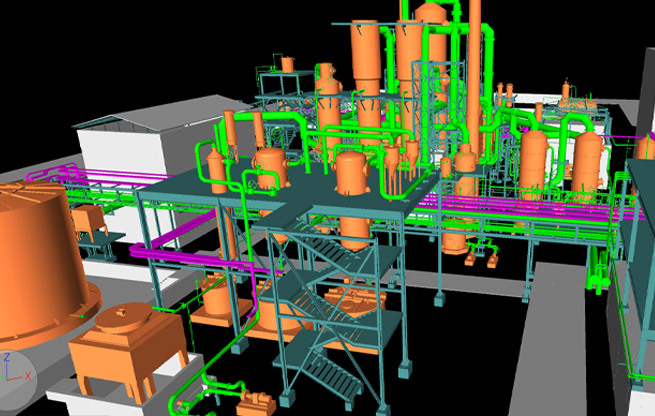
Industrial applications
The above diagram explains the technique used in Laser scanning. Laser beam emitted from the Scanner travels to the target, gets reflected off its surface and then comes back to its source. As the speed of light is a constant value, the LiDAR can calculate the distance to the target as per below formula –
Distance = (Speed of Light x Time of Flight) / 2
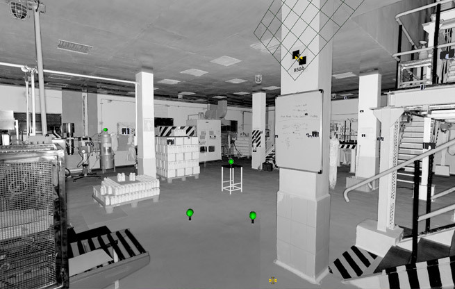
The Scanner device sends multiple laser beams in all three (3) directions (360 degrees) i.e., X, Y and Z Planes with respect to its position and creates multiple point coordinates of its near-by objects. When the scanner completes capturing of images of its near-by area in all three axes then this is called as 1 (one) scan image of the scanner.
During a single scan, a laser scanner will collect millions of 3D coordinates. The result is a 3-dimensional image of the object created by millions of dot-images captured by the Scanner. This 3-dimensional image is called as Cloud Data.
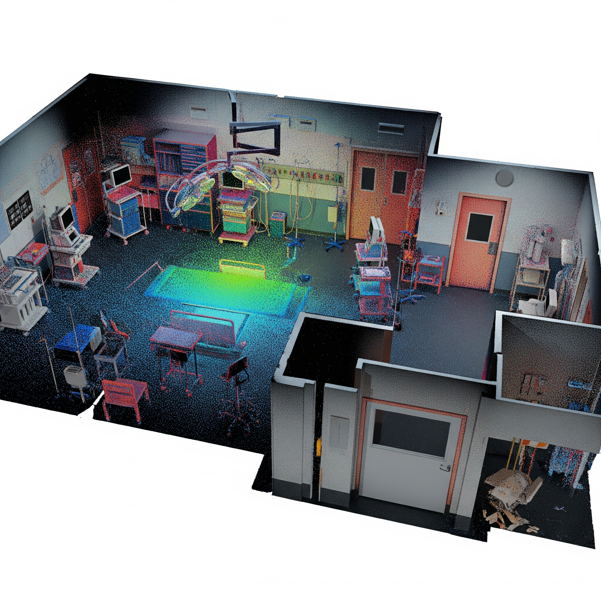
Medical and healthcare
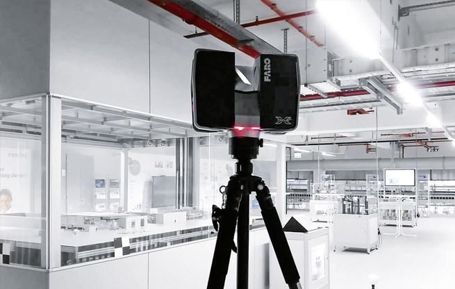
The scanning is done with an electronic device known as Laser Scanner. This device throws out a Laser Beam towards the target object that bounce off surfaces and reflect it back to a sensor installed in the Scanner. The sensor then calculates how far away the surface is by measuring the time taken for the light beam to complete its journey. This process is known as the “time of flight” measurement. The distance measured is then used to calculate a coordinate for the tiny section of the surface hit by the laser beam.
Smart home
The Present-day 3D laser scanning technique involves very advanced technologies and these procedures use laser beams, advanced sensors, Global Positioning Systems (GPS), Inertial Measurement Units (IMU), receiver electronics, and photodetectors. Using all these components, laser scanners can calculate accurate coordinates of surfaces and structures.
Infrastructure applications